Climate change brings significant environmental changes, such as abnormal temperatures and short, heavy rains, leading to the rampant spread of various epidemics.
In long-term collaboration with the National Health Research Institutes, EGIT integrates GIS technology with expertise in epidemiology. We use big data on climate, diseases, vectors, prevention efforts, and regional environmental factors to visualize spatiotemporal changes.
Mosquito Control / Dengue Fever Prevention Management
The development of mobile handheld devices supports field investigations of disease vectors by accurately recording the coordinates of vector traps, breeding sources, and survey times. By integrating data on humans (hosts), mosquitoes (vectors), and the environment, we can gain insight into infectious cycles and perform spatiotemporal analyses of epidemic hotspots. This has helped control dengue fever outbreaks in Taipei and Kaohsiung. EGIT has developed an AI application for mosquito identification through the accumulation of field-observed mosquito photos to improve overall epidemic prevention capabilities.�
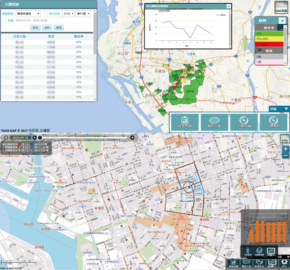
Vector investigation, cases and risk hotspot dashboard
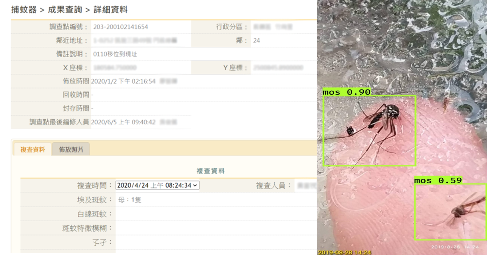
Real-time insight and AI identification
COVID-19 Management
In 2020, EGIT collaborated with the National Health Research Institutes when the COVID-19 pandemic swept across the globe. Based on GIS spatiotemporal analysis, we conducted empirical analyses of various pandemic patterns and constructed mathematical models through graphical and visual representations. By interfacing with data from the Taiwan Centers for Disease Control, we are able to provide daily real-time updates on the development of local outbreaks in Taiwan using chronological chart. In addition, we developed the SEIRV epidemiologic transmission model, presented comparative evaluations of key indicators, and conducted analyses on pandemic progression prediction and traffic transmission models. These efforts are critical cornerstones in advancing Taiwan's COVID-19 prevention and control initiatives.
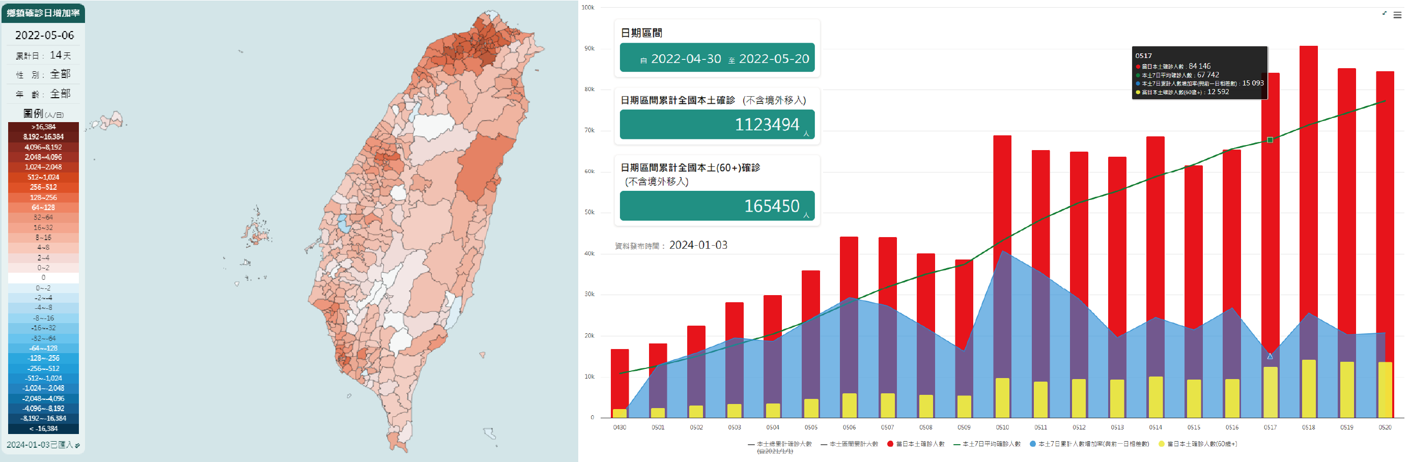
Covid-TW Map
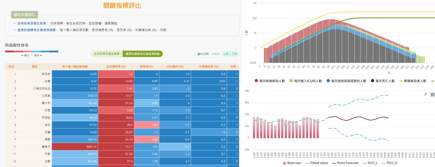
Global comparative evaluations of key indicators, SEIRV model, local outbreak prediction, collaboration with the National Health Research Institutes