
Mobile GIS Cloud Application
The combination of mobile devices and cloud computing is currently the mainstream in system applications. By integrating handheld mobile devices used in the field with GIS technology, EGIT returns systematically collected data in a unified format. This facilitates the subsequent performance displays and value-added applications for the users, providing a comprehensive and professional integrated solution to tackle the impact of pollution.
Advantage of handheld, GIS and cloud integration
- Offline functionality on handheld devices.
- On-site GPS and GIS positioning for enhanced survey accuracy.
- On-site survey data recording for data standardization.
- Real-time cloud upload of on-site data photos for improved remote status update.
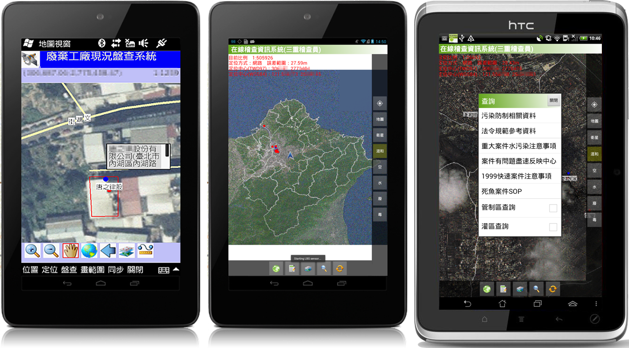
Mobile GIS applied to Inspection, Patrol, Audit
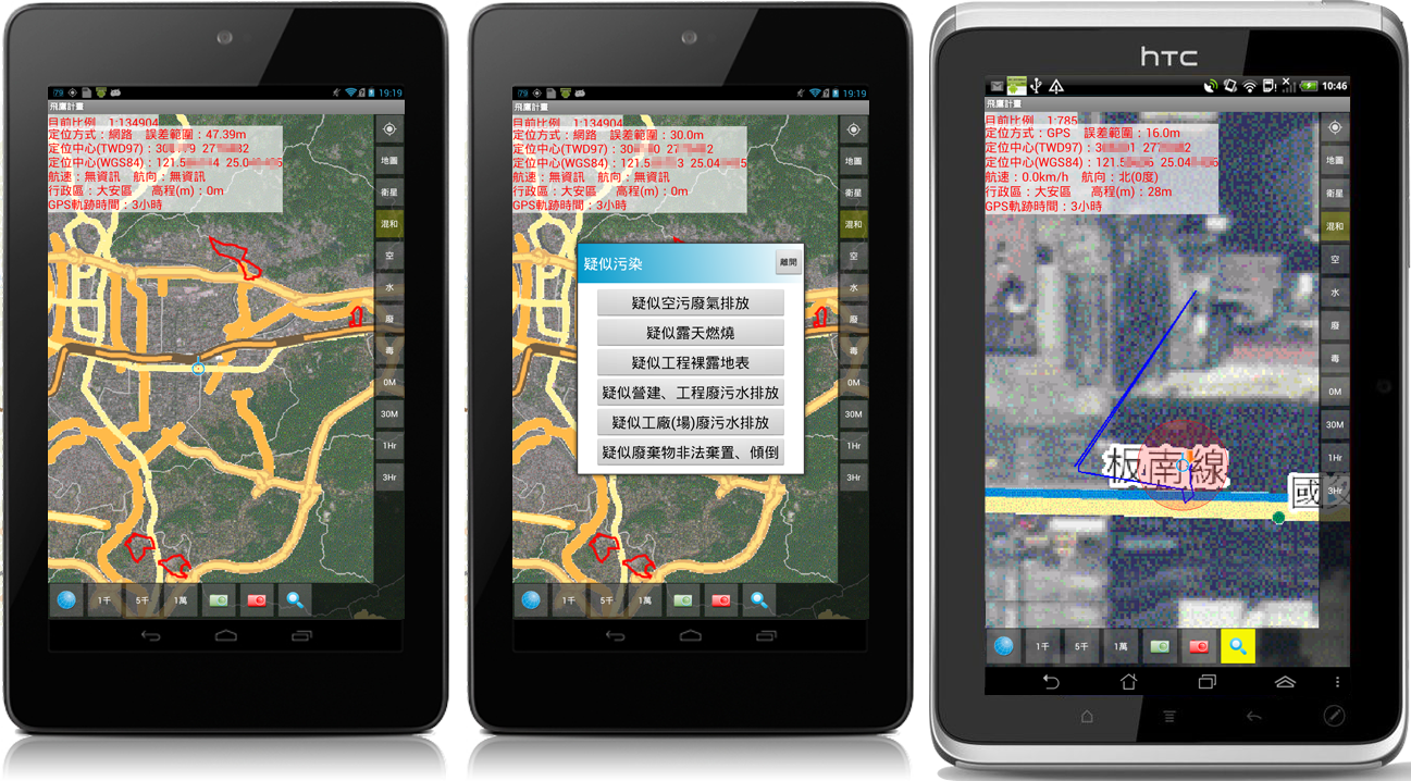
Mobile GIS applied to Sky Patrol
Mobile GIS applied to Off-island Patrol
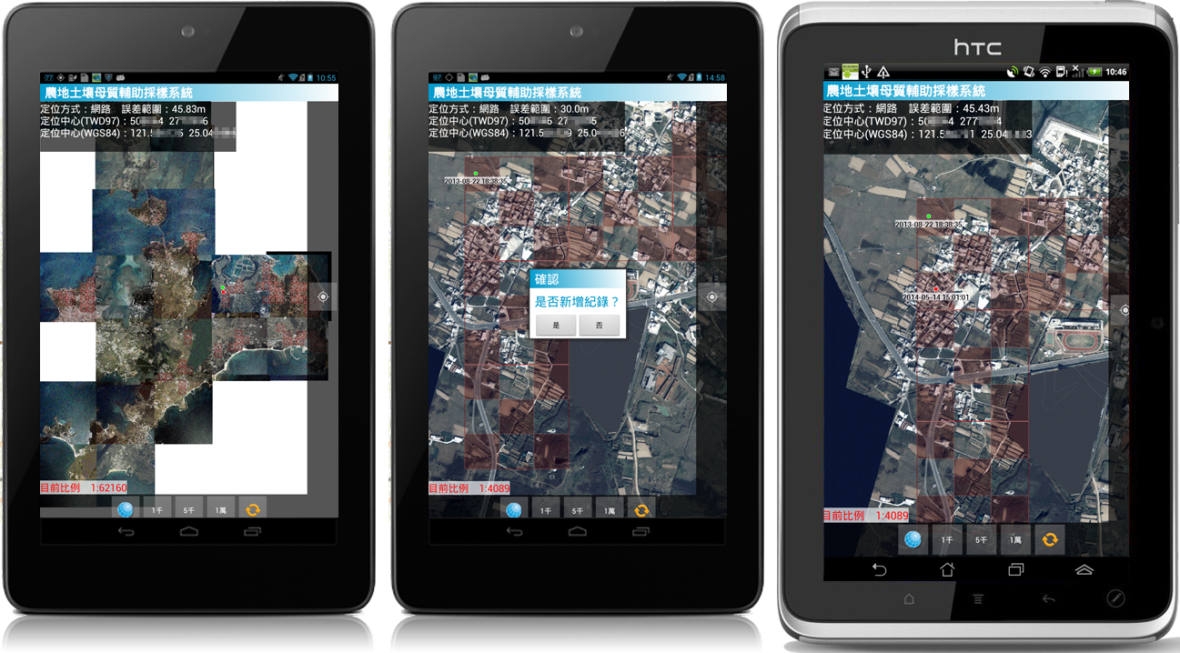
Mobile GIS applied to Sea Bed Sediment Sampling on a Raft
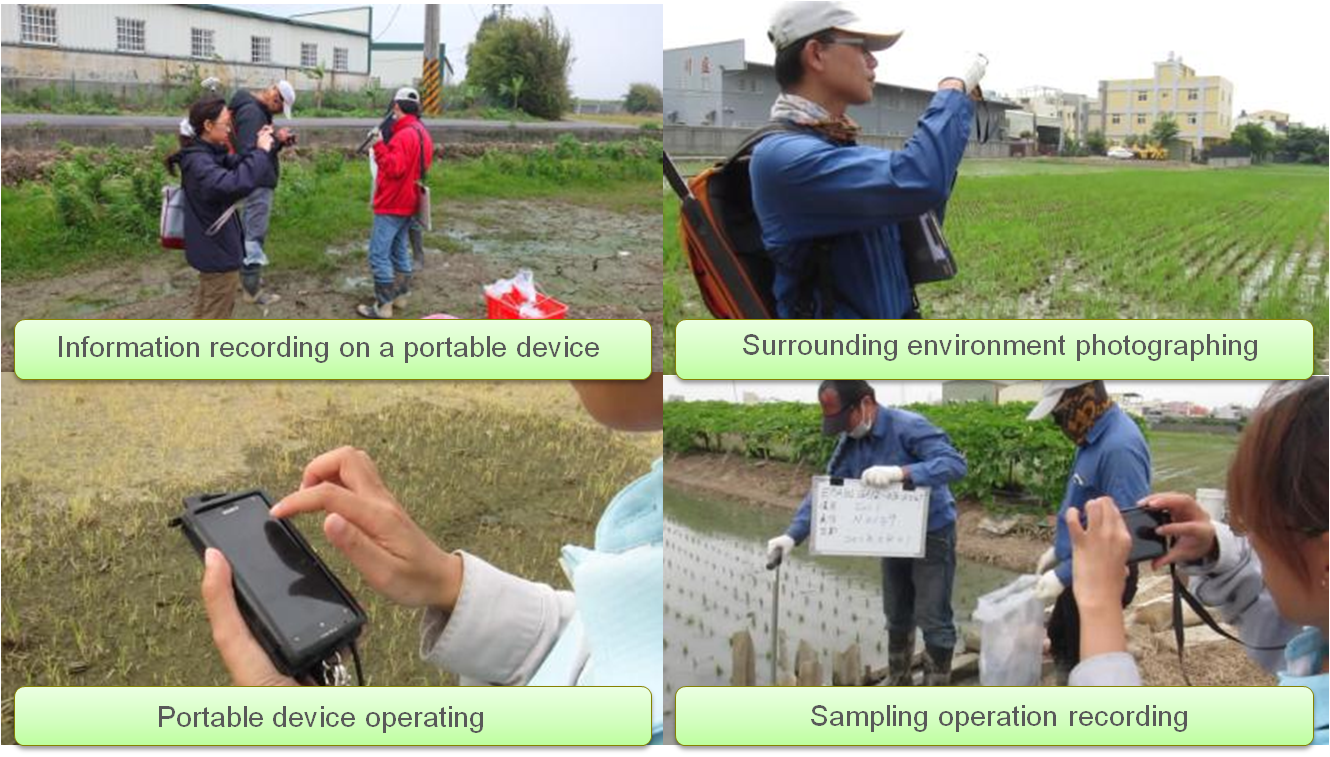
Geospatial information and electronic data on handheld devices play a critical role in streamlining the initial tasks of field surveys. This eliminates the need to carry paper maps into the field and provides real-time recording capabilities and GPS tracking for improved efficiency and documentation accuracy during field operations. In addition, the use of cloud services allows applications on handheld devices to work seamlessly remotely, ensuring automatic updates and flexible expansion or customization. Additionally, the functionalities of the mobile platform allow users to comprehensively track the progress of operations and data outcomes. The unified format of systematic recording facilitates the subsequent performance presentations and value-added applications.
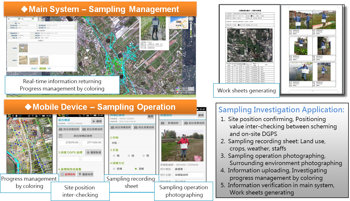
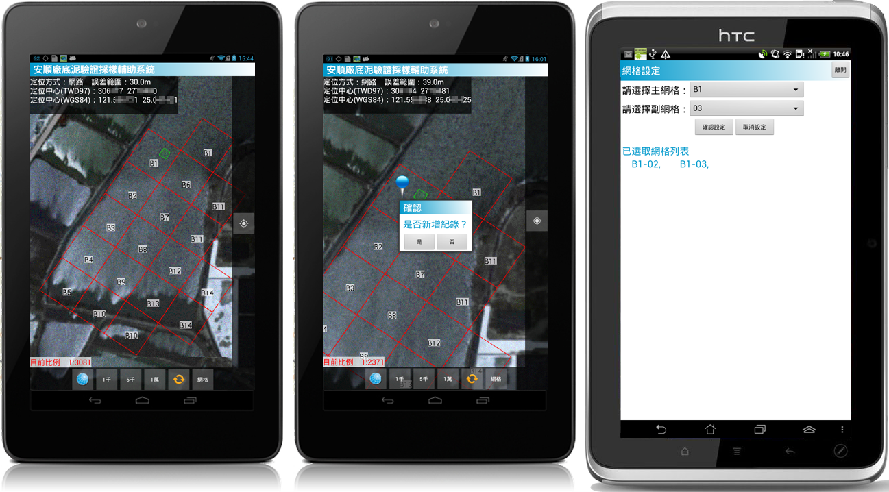
Main system and mobile platform for national agricultural land survey application
The EGIT Mobile GIS platform has been successfully applied in inspection/patrol/investigation/inventory operations for government agencies. Given that survey locations may be situated in areas with poor communication, EGIT fully leverages the offline operations and synchronization mechanisms of the mobile GIS platform. With features such as network connection status detection, session resumption modules, and data validation mechanisms, the platform has full offline operational capabilities, ensuring a 100% success rate for data transmission. Whether on land, in the air, at sea, or in areas without network coverage, the platform can seamlessly execute on-site survey operations and GIS tasks.
Mobile GIS cloud platform used in national agricultural land field survey