Geographic Information System (GIS)
GIS is a software tool for displaying spatial data, and EGIT provides customized GIS solutions based on customers' management needs and operational workflows. The software can run on low-spec PCs and industrial PCs, and is compatible with various devices such as stand-alone, web-based and mobile platforms.
Geographical information map - core technology and solution
In the era of rapid internet development, web-based and mobile platform GIS has become the mainstream requirement. EGIT has developed a web-based GIS framework that prioritizes system security, development flexibility, and performance efficiency, and utilizes open source GIS projects to enable rapid development.
Highlight:
- Efficiently plot a large number of points for presentation efficiency.
- Encrypted transmission for added security.
- Uninterrupted temporal sequence display.

Dynamic GIS AQ spatial map
GIS application
GIS can integrate digital information across multiple domains, including environmental, social, and economic. By presenting continuous historical data and estimating patterns, it enables users to understand the complete trajectory of target events and view them on the map. This facilitates event understanding, future assessment, post-event review, and educational applications, contributing to the overall effectiveness of digital governance.
Specializing in GIS, EGIT offers solutions for spatial analysis and visual representation, enabling decision-makers to swiftly access integrated information within a given region. The spatial analysis spans from single points to lines and areas, facilitating a comprehensive understanding of data:
- Spatial distribution for insight on location relationships.
- Identifying trends through spatial clustering.
- Analyzing spatial consistency.
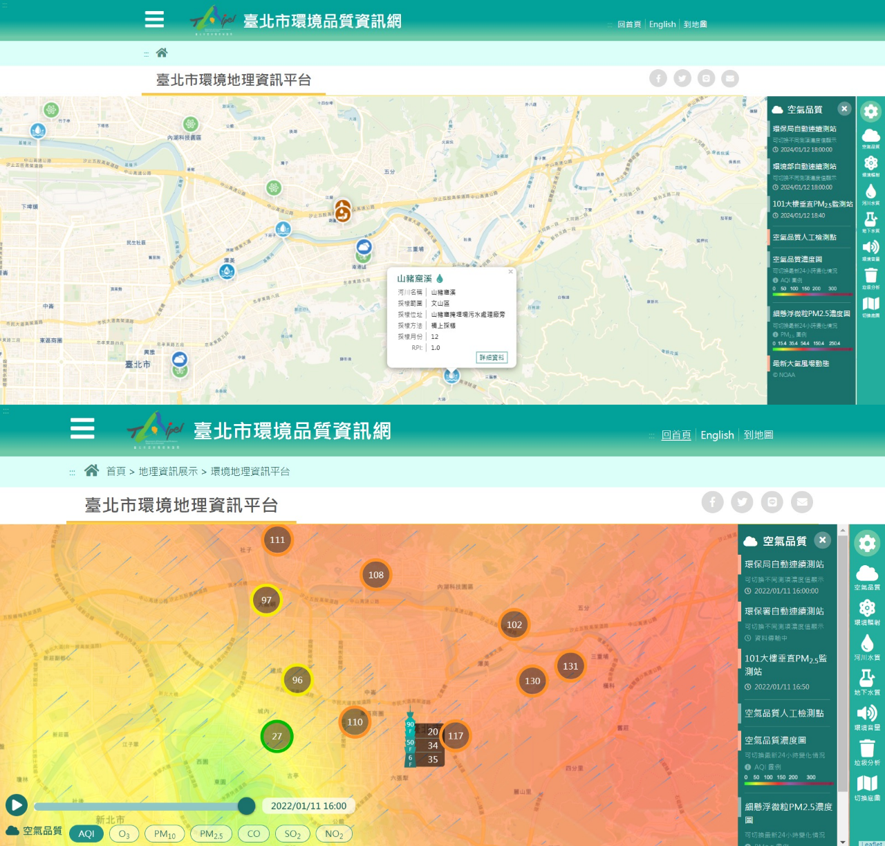
Spatial distribution, real-time AQ index
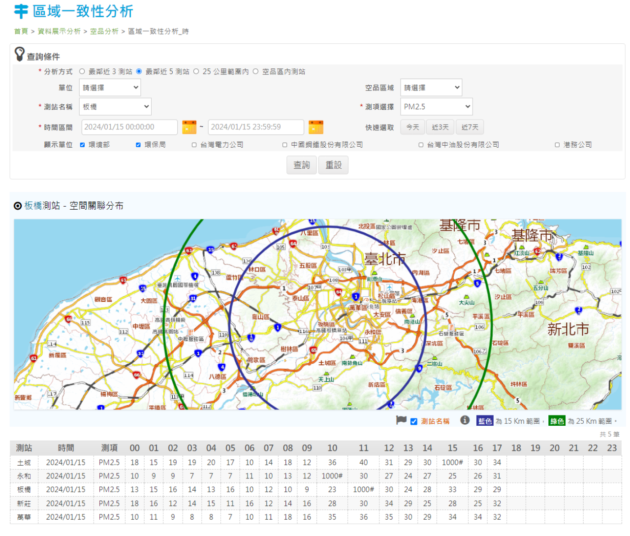
Spatial consistency analysis
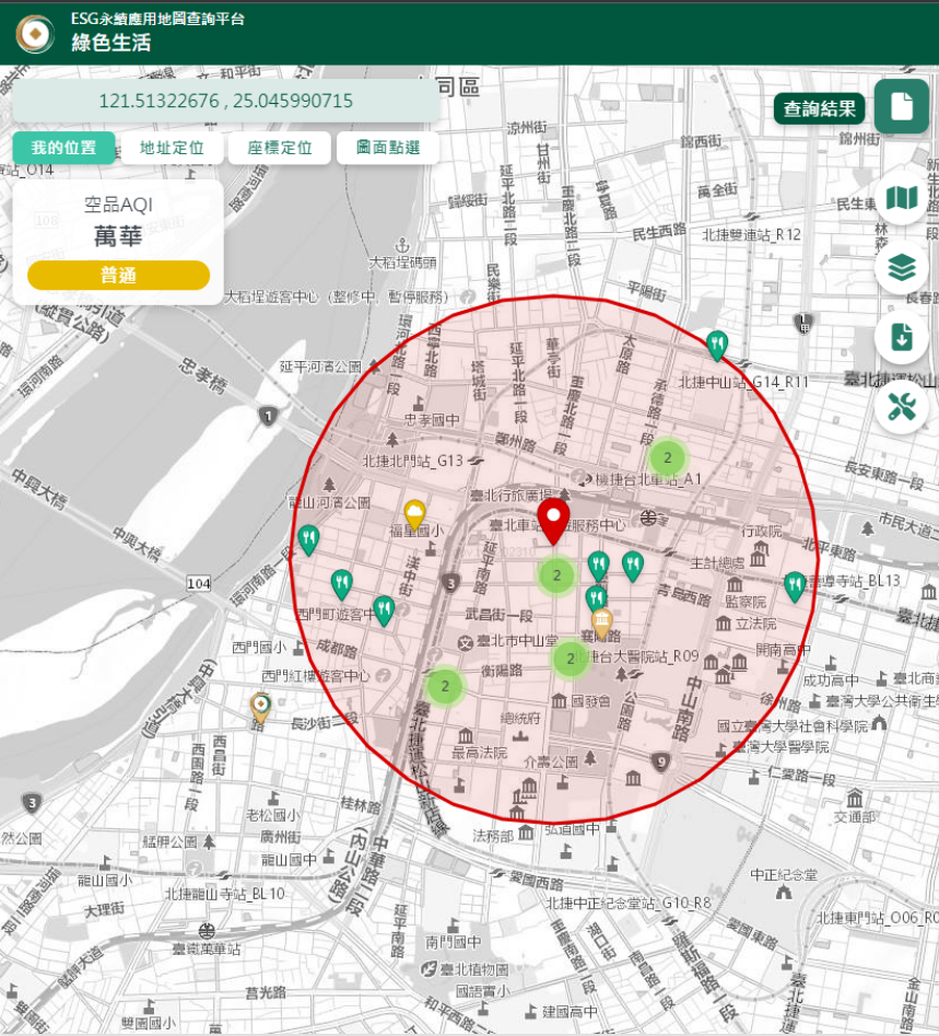
Regional analysis presentation
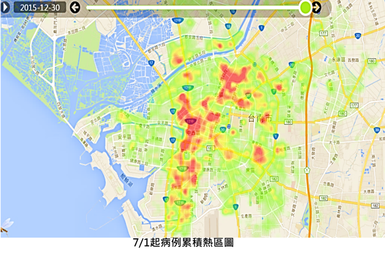
Hotspot analysis presentation
Decision Support System (DSS)
The essence of GIS is an expert calculation platform and tool that can be applied to a variety of fields, for example executing spatial calculation for the DSS. The DSS can provide the management level of organizations with a computational tool for spatial analysis to assist decision making, elevate decision efficiency, and improve decision results through calculation logic and decision procedures as required by the specific application. For example, to the authorities handling soil and groundwater pollution, DSS can be applied in the categorization of the pollution potential or environmental risks of land to establish an order of priority for regional investigation or control site remediation.
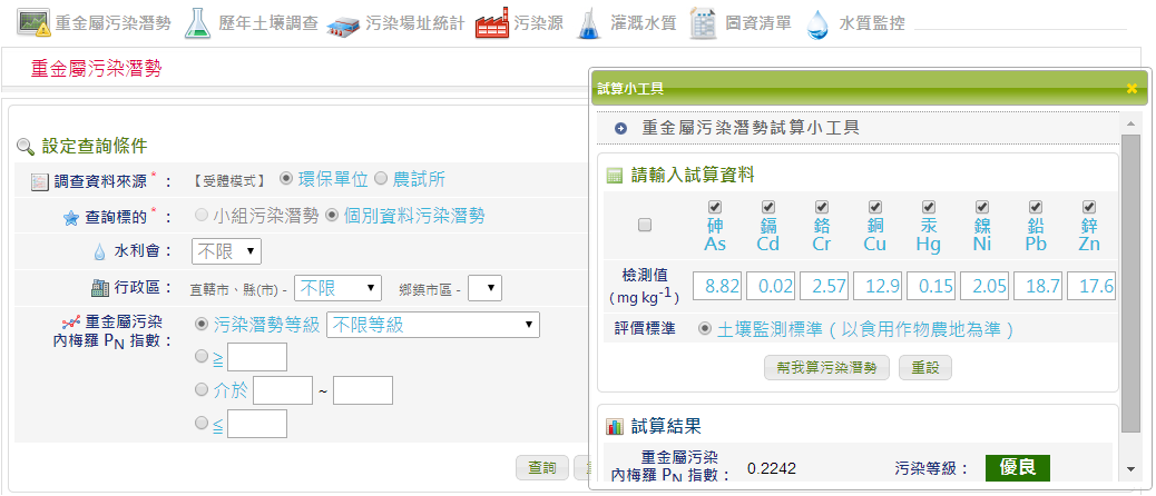
Example of DSS calculation tool - trial calculation of heavy metal pollution potential
DSS can provide users with numerous benefits: it can integrate information required by different departments and offer analysis from different perspectives. Its one-stop platform can ensure the transparency of information, and it is convenient for circulation and sharing. Furthermore, it can promptly transform original data into the results of decision analysis to make sure that users have access to information from all perspectives which paints a complete picture of the overall situation.
A well-developed DSS can continuously monitor key indicators, and a warning is issued in a timely manner when anomalies occur. The DSS can also apply a calculation mechanism for issuing warnings by leveraging expert experience to make sure preventive measures or response plans are adopted as early as possible when potential risks happen.
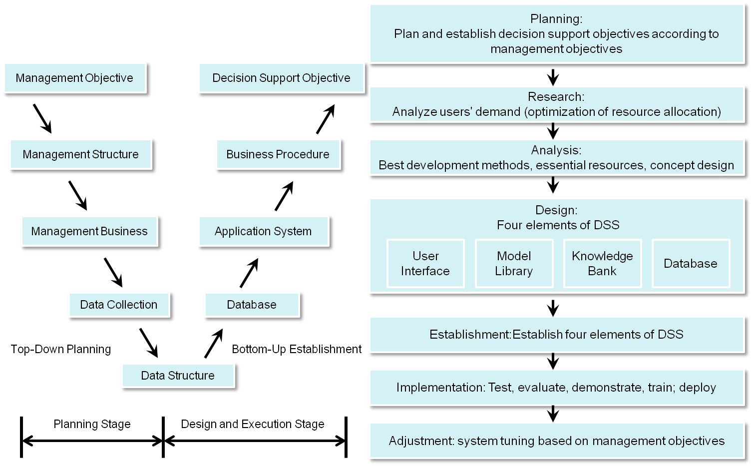
DSS planning structure diagram
Mature DSS can continuously monitor key indicators, and warning information will timely give off when abnormal phenomena occur. It can also develop warning calculation mechanisms with the experience of experts to make sure preventive measures or response plans are adopted as early as possible when potential risks happen.
Application of DSS visualization
EGIT's DSS projects include:
- Assess contamination potential or environmental risk classification for a large land area, helping to determine priorities for site or regional investigation or remediation.
- Emergency response to poor air quality, combining air quality monitoring and pollution dispersion model estimation.
- Track sources of water pollution by combining IoT spatial consistency and temporal analysis for inspection.
- Dengue hotspot identification, combining case distribution and vector survey to identify hotspots.
- Intelligent dispatch of inspection tasks (selection of optimal paths).
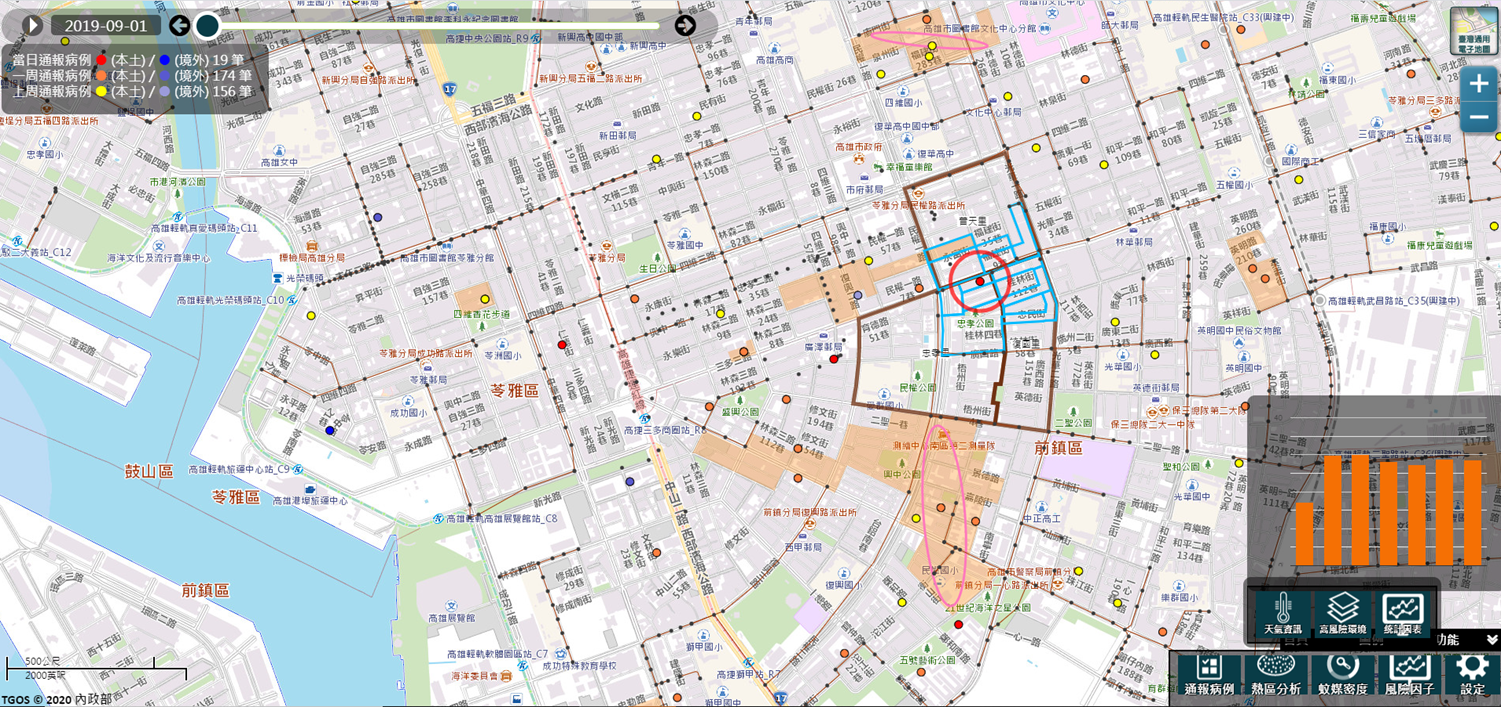
Mosquito vector alerting and DSS integrated platform
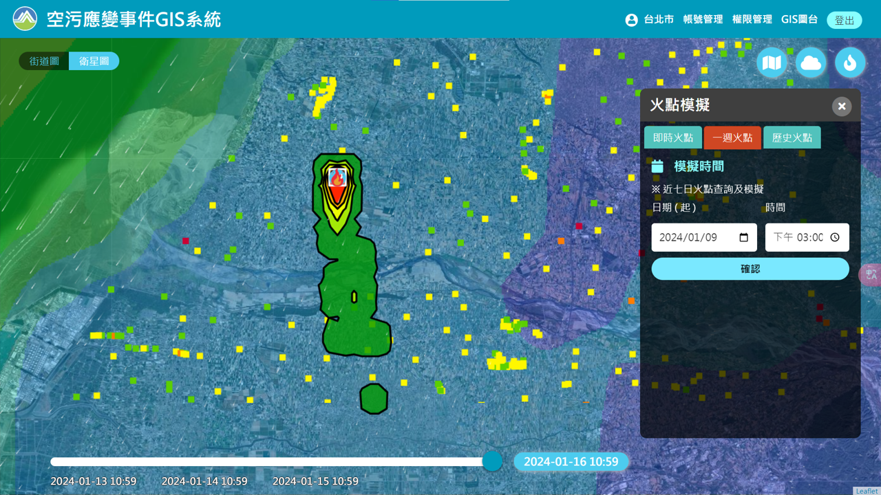
AQ emergency response GIS